UAS Operations • Drone Services
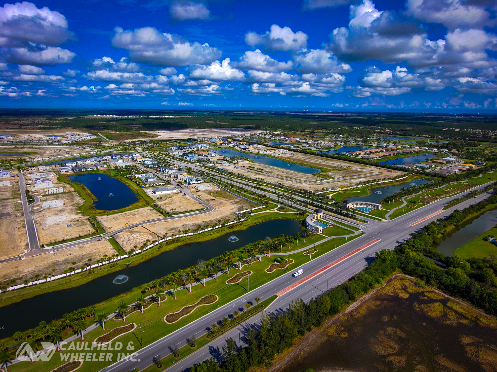
Caulfield & Wheeler, Inc. (CWI) is proud to offer FAA Part 107 licensed and insured unmanned aerial systems (UAS) or drone operations to complement our engineering, surveying, & landscape architecture services. By utilizing the most recent technology available on the market, CWI can accurately document, inspect, photograph, video, 3D model, or aerial lidar scan a wide variety of projects or areas previously too large or unreachable by traditional GPS field crews. By implementing the highest quality peripherals like American-made RTK GPS-equipped drones and aerial lidar solutions, we can provide various services and deliverables for our clients to maximize their development projects. Caulfield & Wheeler, Inc. has a proven track record of obtaining FAA and LAANC authorizations and waivers to analyze and fly project sites close to international airports, stadiums, or other warning zones. Through aerial lidar & photogrammetry, CWI can collect, maintain, and utilize large amounts of data for various survey purposes, including topographic surveys, asbuilts, cut/fill analysis, and generation of high-resolution orthomosaics of real-time existing conditions.

Caulfield & Wheeler, Inc.’s UAS Drone Operations team can provide the following services:
- 2D Mapping & Orthomosaics
- 3D Modeling
- Agriculture Inspection
- Aerial LiDAR
- Construction As-Builts
- Construction Progress
- Cut & Fill Analysis
- Damage Assessment
- Photogrammetry
- Photography
- Pre-Construction Documentation
- Post-Construction Documentation
- Site Inspection
- Topographic Surveys
- Utilities Asset Inspection
- Videography

Caulfield & Wheeler, Inc.’s UAS Operations Team featured on Down to Earth with MicroDrones & GeoCue
Highly Accurate Lidar Data & Orthomosaics

Use Cases:

Future Land Development

Topographic Surveys

Transportation & Utilities
No Crane? No Problem.
CWI Offers Repeatable Interactive Panoramic Imaging
Desktop: Use your mouse by clicking and holding to pan left and right or tilt up and down, and your scroll wheel to zoom in and out.
Mobile: Use your finger to pan left and right or tilt up and down, and pinch your fingers to zoom in and out.