


High Definition 3D Laser Scanning • LiDAR
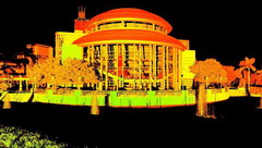
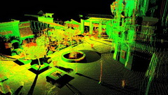
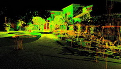
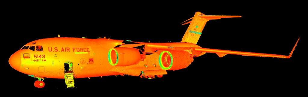
Caulfield & Wheeler, Inc is proud to offer a variety of high-definition 3D Laser Scanning solutions to complement our traditional Land Survey techniques, in order to provide our clients with highly accurate deliverables. CWI utilizes the latest high-definition 3D Laser Scanning tools from Leica Geosystems, including the HDS3000, P30, and P50 scanners. CWI is also proud to incorporate intelligent vehicle-mounted scanning systems into our workflow, allowing us to scan much larger areas in a shorter amount of time, as well as areas previously inaccessible to field crews on foot like roadways. Additionally, Caulfield & Wheeler implements multiple hand-held scanning devices, which allow us the ability to reach areas that are entirely unobtainable with a larger scanner, like the inside of pipe systems and underneath manhole and sewer grates. The efficiency and accuracy of CWI’s high-definition 3D Laser Scanning solutions provide our team and client’s an invaluable amount of data, which translates into better final deliverable products.
For more information, please contact our Survey and 3D Laser Scanning departments.